Introduction According to Law Number 3 of 2002, National Defense is all efforts to defend the sovereignty of the country, the territorial integrity of the land, sea, and air of the Unitary State of the Republic of Indonesia (NKRI), the safety and security of the entire Indonesian nation from all forms of interference or threats either coming from abroad and from within the country. In order to maintain the sovereignty and integrity of land, sea, and air areas, the Republic of Indonesia uses components of the Indonesian National Army (TNI); reserve components which are human resources (HR) prepared to be deployed through mobilization to strengthen the capabilities and strength of the TNI; supporting components consisting of all natural resources contained in the earth, water and air which can be used for the benefit of national security as well as increasing the capability and strength of the TNI and reserve components.
Considering the breadth of components to defend the sovereignty of the Republic of Indonesia as well as the territorial integrity of land, sea, and air to ensure the safety and security of the entire Indonesian nation from all forms of disturbance. This paper; is only limited to the use of unmanned aerial vehicles (UAV),2 remotely piloted aircraft (RPA),3 or drones4 or unmanned aerial vehicles (PTU) in relation to air transportation, natural resources, especially forestry, agriculture, plantations, International trade to Europe, the United States and Russia is in the interests of national security as follows.
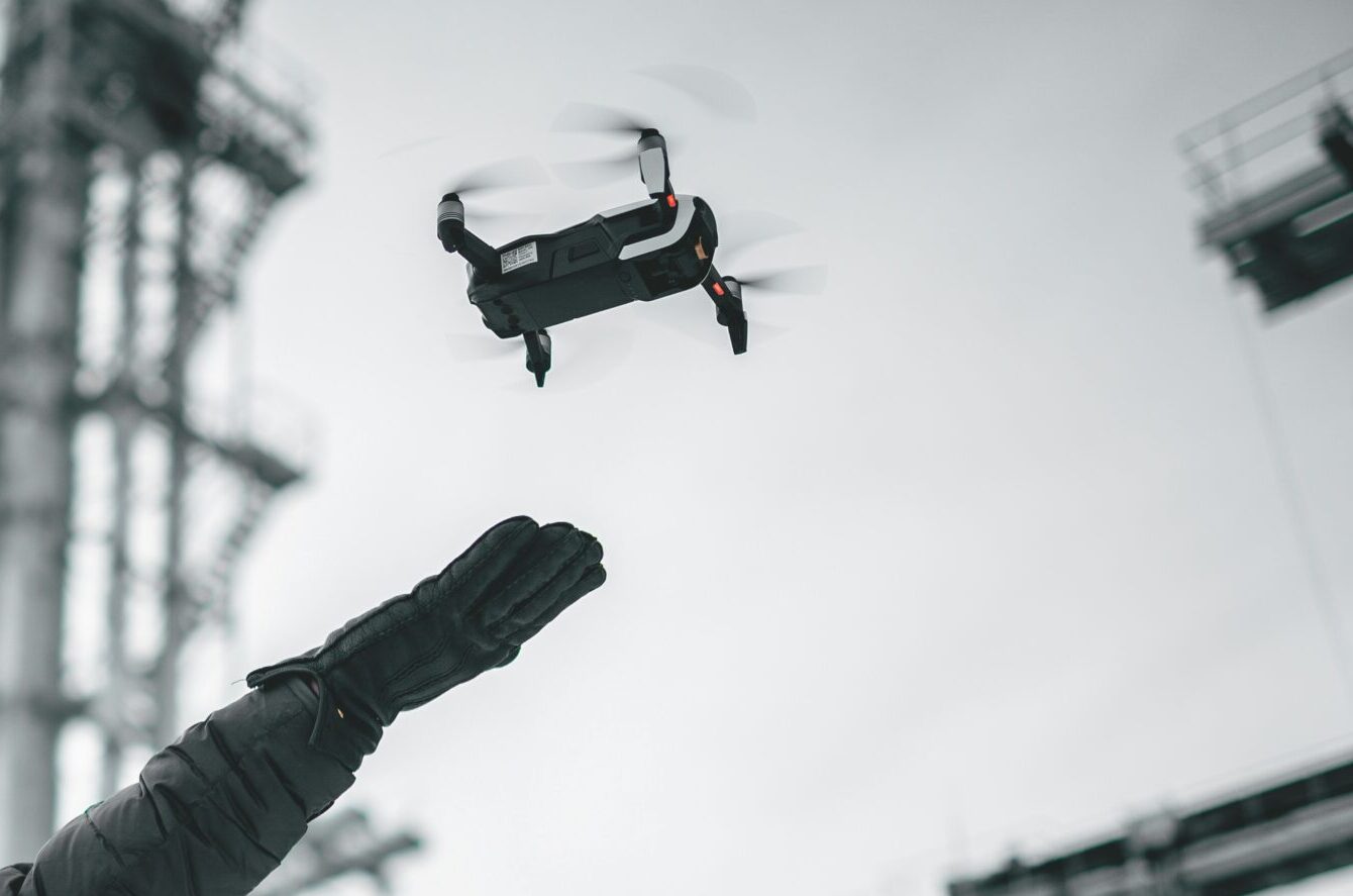
2. The Importance of Using Drones
The use of drones is very important because this technology can present information practically, is easy to operate without the need for special and authentic skills, so that it can support data and information-based strategic decision-making processes. Drones can easily help industrial players to identify basic problems for more efficient business operations, therefore, the Ministry of Environment and Forestry through Ministerial Regulation No P.32/MenLHK/Setjen/Kum.1/3/2016 requires companies to have Drones as an early detection tool for forest fires.
The National Land Agency (BPN) through Technical Instruction No. 02/JUKNIS- 300/2017 also explains the standards for using drones to create work maps in the context of accelerating Complete Systematic Land Registration (PTSL), as well as President Jokowi instructing Candidates for Youth Officers at the TNI and Polri Academy, must master drone technology for various purposes.
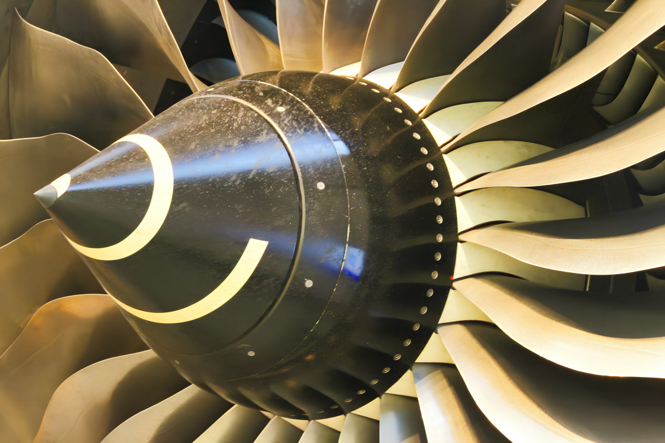
In Indonesia, drones have been used by the Indonesian Air Force (TNI-AU), for aerial photography, mapping, TV media, film, news filming, sports, fishing, mining, natural resource inventory, police, SAR, infrastructure inspection, and advertising. & video, entertainment, logistics, commercial, reclamation, forestry, firefighting, forest fire hotspots, palm oil plantations, agriculture, coast-guard, border-crossing, mining, tree counting, planning toll roads, flood control, pipe monitoring, highway construction, earthquake recovery, natural disasters, spraying disinfectants, transporting people which can carry 200 kg up to a distance of 100 km, it is even planned that by 2025 we will be able to transport cargo by drone.
3. Drones for Forest and Land Fires
a. Indonesia
An industrial plantation forest company in Ogan Komering Ilir (OKI) Regency, South Sumatra, PT Bumi Mekar Hijau (PT BMH) uses drones to maximize all the company’s resources and implement the four pillars of the Integrated Fire Management (IFM) management system to anticipate fires forest and land respectively prevention, preparation, early detection, and rapid response. Apart from that, drones are also used to monitor concession areas to prevent forest and land fires.
In areas that are difficult to reach and cannot be seen from fire towers, patrols use drones to assist with monitoring. Apart from that, drones are also used to identify community activities in conflict and fire-prone areas. If a fire is found, its location can be seen using a drone. Through this technology, the company’s fire brigade can obtain information on the position of the source of the fire and an estimate of the area of the burned area, so they can take tactical steps to prevent the fire from spreading further because they can look for the nearest water source. The use of drone technology is also needed to monitor post-forest and land fire activities, such as calculating the area burned covering a fairly large area and the data obtained can be used for planning and decision making in controlling forest fires.
In order to deal with forest and land fires that occur every year; and illegal encroachment, PT DI makes drones to carry out continuous monitoring regarding climate changes, sources of fires, detection of land moisture, eradication of forest fires, smuggling, terrorism,9 and other natural resources. The drones made by PT DI are designed for civil and military purposes and can take off from a runway 700 meters long, an altitude of 20,000 feet, cruise at 235 km per hour, and stay in the air for 30 hours. The drone is planned to be completed next year and will be equipped with the necessary weapons.
b. Türkiye
The use of drones for fighting forest and land fires is also available in Turkey. On August 1, 2021, Turkey mobilized all forces to extinguish fires that scorched cities in the country’s south. Over the past week, the fire brigade used airplanes and helicopters, everyone helped put out the fire. Domestically produced drones, namely the Aksungur and Bayraktar TB2 drones, were also deployed to extinguish the fire. Aksungur’s drone detected three employees inside the tower and helped them escape the flames. Bayraktar drones are entirely Turkish production, all Eurodynamics software, designed with the most advanced system in the world in its class. Drones in Turkey are often used to monitor and extinguish forest fires, usually to detect, contain, and extinguish fires, to monitor forests to prevent sabotage attempts and other potential dangers, that can trigger fires.
The Turkish-produced drone can fly for 24 hours at a height of 27,030 feet carry a payload of up to 150 kilograms and can operate day or night. The Bayraktar drone is often used by the Armed Forces for counter-terrorist operations, while the Aksungur drone developed by Turkish Aerospace Industries (TAI) can fly at medium altitudes and is durable, can carry payloads of up to 750 kilograms, and is capable of flying in long operations at a height of 40 thousand feet. Recently the drone broke a record by flying for 49 hours. This year Turkey used high-tech drones that can print threedimensional models of disaster sites in the country’s northwest.
4. Drones for Agriculture
a. Food Granary Kalimantan
The government is building a food barn (food estate) on an area of 10,000 hectares in Pulang Pisau Regency and 20,000 hectares in Kapuas Regency in Central Kalimantan. Apart from that, the government is planning a food estate covering an area of 163,000 hectares by 2025 so that Jokowi will no longer have a burden because he has carried out the mandate of his voters. Jokowi must step down by law by law in 2025, just like the previous president.
Construction of a food barn (food estate) in Central Kalimantan using drones for fertilization and using floating tractors to plow rice fields. The use of high-tech drones can regulate land mapping, water distribution, flood monitoring and control, fertilization, seed distribution, plant monitoring, eradicate rice plant pests, calculate the labor required, etc., while the use of floating tractors can plow 2 (two) hectares each day because the land is very large.
The construction of a food barn (food estate) is not only for rice farming, but can also be developed for intercropping crops such as mangoes, bananas, oranges, corn, coconuts, vegetables such as shallots, garlic, cucumbers, long beans, and turi trees. But for Madiun pecel, fisheries such as caged fish, chicken farming, ducks, muscovy ducks, cows, buffalo, goats, horses, by-products such as banana chips, corn chips, and corn oil will all create the necessary workforce, so that food security is sufficient in the country without importing food from abroad. Jokowi is a President who likes to travel to regions to check whether his programs are being implemented or not, because of that, on October 8, 2020, Jokowi witnessed the construction of a food estate in Central Kalimantan using a presidential aircraft purchased by the previous President, SBY. Jokowi asked about the ability to plow fields with a floating tractor.
The Jokowi government is also trying to create a post-harvest industry that can accommodate all commodities produced by agriculture and plantations. This industry is expected to be able to increase the selling value of agricultural and plantation products which can be marketed through e-commerce. Apart from that, Jokowi emphasized that agricultural products from food estates should also encourage the off-farm industry. In contrast to on-farm which is closer to the plant cultivation process, off-farm is more concerned with post-harvest development.
Some examples of off-farm businesses are making chips from tubers or dodol from garden produce as mentioned above. The food estate program has been running in a number of areas. In North Sumatra, the government is running a horticultural food estate project in the Humbang Hasundutan Regency. Initial work was carried out on 1,000 hectares of land from the original plan of 4,000 hectares. In this case, there are a number of companies that have invested in horticultural food estates, including PT Calbee Wings Food, PT Champ, and PT Indofood Sukses Makmur. The horticultural food estate is focused on three food commodities, namely industrial potatoes, garlic, and chilies. According to them, there are no obstacles in preparing the food estate because the location of the area has been determined and administrative problems have been resolved.
b. Food Barn (Food Estate) in NTB
Food barns (food estates) are not only built in Central Kalimantan, but also in West Nusa Tenggara (NTB) to grow corn because the land is large and has the potential to increase corn farming, however in NTB there are still water problems, because in NTB the river flows short distances, every time it rains the water quickly flows into the sea, so there is less water absorption in the land, therefore the local government must create reservoirs to accommodate the water needed by the agricultural sector so that one year there can be two corn harvests. With the presence of reservoirs in NTB, corn farming, and its related products can be developed so that it does not disappoint the agricultural community. As is the case in Central Kalimantan, food estates in NTB can also use drones or floating tractors.
c. Cassava Development
President Jokowi appointing Prabowo Subianto as Minister of Defence is very appropriate because, during the Presidential Election campaign, Prabowo Subianto together with Santiaga Uno from the Gerindra Party campaigned for a food barn program, Prabowo Subianto definitely had a good grasp of the issue of providing national food for national defence. Now he is focused on handling cassava development, in order to support the food estate program. According to him, cassava is really needed domestically, because cassava can be consumed directly or processed into tapioca flour or mocaf which can be used as an ingredient for bread and/or noodles, so that Indonesia is not dependent on imports from abroad. If the food estate can be done well, Indonesia can plant 30,000 hectares of cassava in Central Kalimantan in 2021 and continue to increase to 1.4 million by the end of 2025.
5. Drones and Transportation
The Indonesian government is targeting Post Covid-19 to end in August 2021. Post Covid-19 drones are very important for the life of nations in the world, including national transportation in Indonesia and internationally, therefore ICAO13 is very interested in regulating drone operations to ensure flight safety and security as mandated by Article 44 letter (a) of the 1944 Chicago Convention.
In the field of transportation, drones can be used to deliver goods, as has been done by the DHL company in Europe, sending personal protective equipment (PPE) in the context of dealing with Covid-19, sending medicines (medical care) to remote areas such as in the UK and in Africa, delivery of pizza from restaurants to customers, transportation of passengers over short or medium distances, transportation of cargo using drones to remote areas that are difficult to reach by land or water or air transportation, the Minister of Transportation, Ir Budi Karya Sumadi, is very concerned about the use of drones as transportation.
The use of drones as a means of transportation requires considering the risks that will occur, especially the issue of legal responsibility towards the sender or third parties who have no interest in drone transportation, but suffer losses due to accidents that occur. Accidents will happen anytime and anywhere as evidenced by the drone operator in Singapore who fell on the MRT rail, the collision between a drone and a helicopter flight practice in the United States, the closure of Heathrow airport in England due to drone operations, the same thing happened at the airport. Changi, Singapore, even the use of drones to connect high voltage electricity (SUTET)18 in Pati Regency, Central Java some time ago. In the next 20 years, it is possible that airplanes will be replaced by drones without pilots, without cabin crew and passengers will not have to queue for long check-ins at airports, because everything is done robotically based on intellectual intelligence. In this regard, the millennial generation must follow technological developments that are developing by referring to science, technology, engineering, and mathematics (STEM), which is the ICAO reference, followed by Human Social Science (HSS) so that the development of high technology can improve human welfare. The development of high technology without HSS will make life in this world miserable.
6. Drones and Palm Oil Plantations
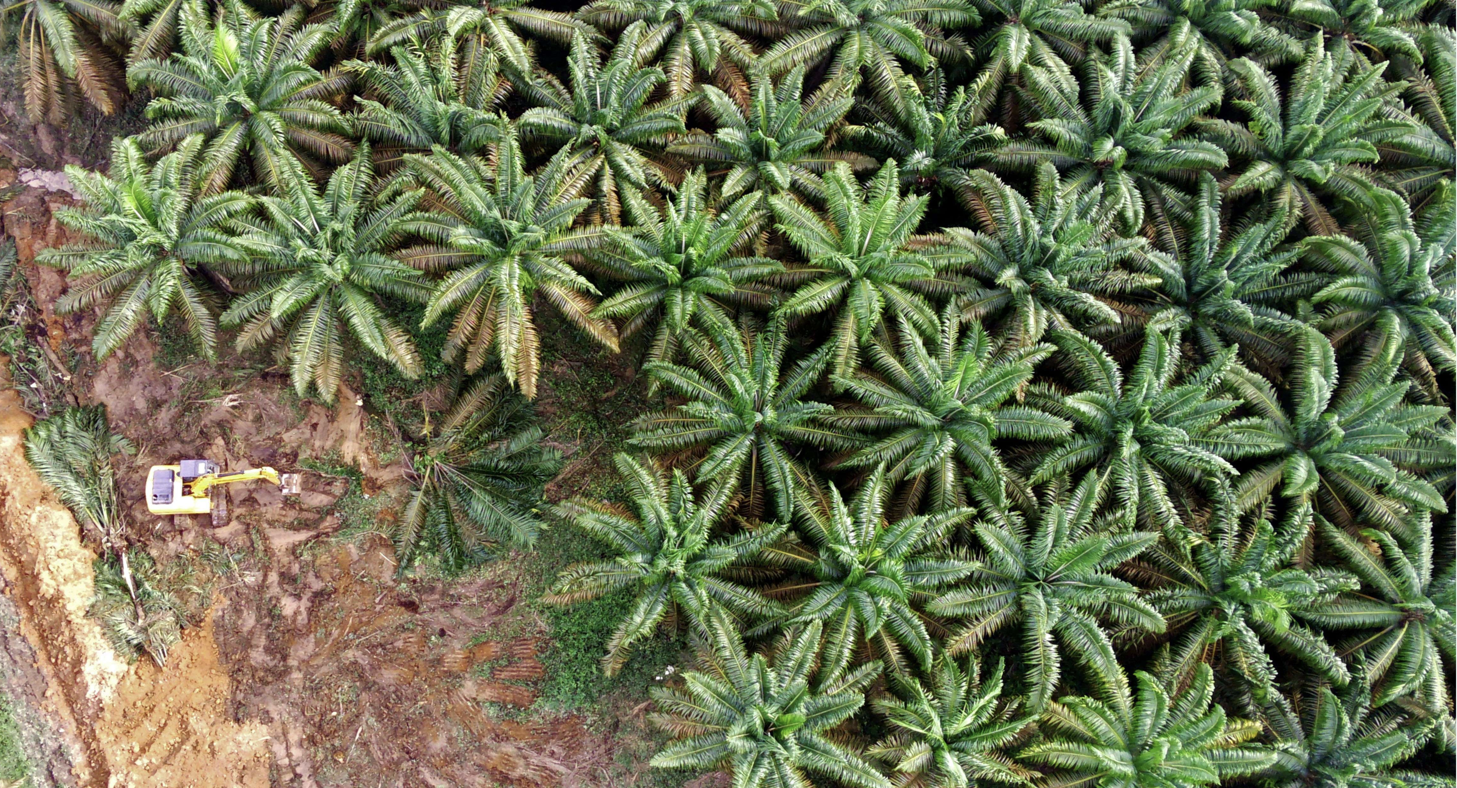
So far, the general public has only known drones as a hobby, but in Indonesia and Malaysia, the use of drones is starting to be increase to overcome forest destruction and illegal forest encroachment. Many large palm oil companies in Indonesia and Malaysia already have drones. Currently, the use of drones is starting to be followed by medium-scale gardens. Before the use of drones, a number of companies owning palm oil plantations in Sumatra used traditional methods to control their millionhectare plantations using helicopters. Using drones to monitor oil palm plantations is very profitable compared to using helicopters.
Apart from that, drones can also monitor fire spots which are sometimes located near their plantation concessions. The source of fire from illegal forest encroachment has been a complicated regional problem for years, therefore the future is using drones to identify protected forests as areas of high carbon stock. Many plantation companies send staff to practice flying drones and expand their use to other areas. In this connection, the Indonesian government actually has satellite images to help identify when forest fires occur or the source of fires, but slow information, delivery and poor image quality have made a number of oil palm plantations choose to use drones.
Since 2015 Eagle High Plantations (EHP) decided to use drones as a cost-effective tool and provide management with access to data from an aerial perspective, allowing them to see a larger area from a particular location, especially if the area is very large, remote and forested. dense, however, it depends on the type of drone used to increase labor productivity. Drones that are often used in palm oil plantations are usually fixed-wing drones for use at the start of aerial service because they have a longer flight time, so they are able to hover in the air longer to take photos that will be further processed with mapping software. Aerial survey maps are used for different purposes, depending on the stage of development. In the initial stages, it is usually used to detect empty locations in a new planting area, or if there are dead trees and the assigned workers pass by that location. When palm fruit begins to ripen, surveys can also detect disease or palm trees experiencing nutritional deficiencies. Another type is the hover drone which is used for spot monitoring which covers a wide area and provides a wider viewing angle through the mounted camera shot; so that it can be viewed simultaneously from the controls below. This type of drone can be used to detect and prevent land and forest fires which often disturb palm oil plantations, especially during the dry season.
Many plantation companies have used drones effectively to detect fires. Conventional fire detection before drones was a combination of the use of manned fire monitoring towers and motorized patrols of the land. However, these conventional fire detection measures have limitations. Current regulations require one watch tower for every 500 hectares of area and a standard fire tower 15 meters high. The viewing angle automatically reduces rapidly if the palm trees become older and if the tower is not placed in a high area. In comparison, drones are capable of flying to a height of 100 to 200 meters and have a horizontal flight radius of one kilometer.
Fire towers cost between 100 to 150 million Rupiah to build, while depending on the type, drones cost between 30 to 40 million Rupiah, and are also very practical. Since the 2019 fire season, using drones has been very useful for detecting the location of fires that are raging outside plantation concessions. Without using drones, plantation companies will not be able to assess the potential threat of fires outside their concession areas.
Satellite hot spot data can indeed direct you to hot spot areas, but determining whether the hot spot will become a fire requires visual confirmation, and access is always a problem when we happen to be in remote areas. Drones make it possible to survey fires that are raging far outside the concession area, then determine whether it is necessary to prepare extinguishing equipment if a fire occurs in the concession area. One of the players providing services for palm oil plantations is a Hong Kongbased technology company called Insight Robotics. Having served the environmental and plantation industries operating in several countries, they began operating in Indonesia in 2013, with the development of the Aerial Survey business unit.
Since early 2017, Insight Robotics began to shift the focus of its aerial survey services business to more involvement in image processing and analysis, including direct verification of reports for plantations. If clients entrust the process from the initial stages of flight planning and taking photos, they have a team of experts in the field of remote sensing for palm oil. To date, his company has handled six projects for four palm oil companies which are among the five largest palm oil companies in Indonesia and Malaysia. For these projects, the focus is on processing data from images that we obtain from satellite imagery. The acquired images are then processed using artificial intelligence that we have developed to achieve up to 95 percent accuracy, which can be improved with human-assisted quality control.
Most palm oil plantations still focus on using drones to map and monitor fires, and not many use them for fertilization purposes, because of the risk of losing drones due to carrying heavy liquid fertilizer. For fertilization, we have not yet met a plantation company that has adopted drone technology, because of the high risk if the drone falls or disappears. Palm oil companies are still considering using human labor, which is much cheaper. With the many challenges facing the palm oil industry, drones have proven to be an effective tool to help improve sustainability in the industry.
Drones have an important role in the palm oil plantation industry where they are used to survey empty land, determine location mapping, and increase labor productivity; the use of drones for surveys, oil palm plantation fires, tree care (nutrition), eradicating pests (pepsides), research on trees that are no longer productive, detecting fires outside the concession area, replacing conventional monitoring with drones and is cheaper. Without using drones Eagle High Plantation (HCV) is unable to increase its production. Palm oil is the mainstay of Indonesian exports, a source of foreign exchange for the country, in international trade it can be exchanged for Sukhoi-type aircraft or weapons with Russia and training for Indonesian Air Force (TNI-AU) personnel to strengthen the country’s defence or exchanged for Airbus aircraft in the European region to strengthen transportation needed by the TNIAU or commercial aircraft to strengthen civil aviation.
Monitoring oil palm plantations using drones will later produce maps and information to identify land boundaries, age, and height of oil palms, count the number of trees, and estimate harvest yields per hectare. Apart from that, the resulting data can also provide information about plant health, as well as potential diseases and pests in oil palm trees, so that plantation owners can fertilize and eradicate pests more quickly. The results of drone technology can help the process of collecting information needed for certification much more quickly and efficiently. Drones are used in the palm oil plantation industry because they are proven to save time and costs compared to conventional monitoring. This is supported by drone technology which is capable of carrying various kinds of payloads and sensors that can be used to obtain data quickly and relevantly. The Indonesian Palm Oil Entrepreneurs Association (GAPKI) also supports the use of drones to increase effectiveness and efficiency in oil palm plantations. Apart from that, drones are also used by other industries such as construction, mining, oil & and gas, and energy.
The palm oil industry is a strategic industry that is able to support the economies of developing countries due to the high demand for palm oil for both domestic use and export purposes. Indonesia and Malaysia are the largest exporting countries in the world, in Malaysia and Indonesia the oil palm plantation industry is the backbone of overcoming poverty among farmers. The income of farmers involved in the palm oil plantation industry has increased 2-7 times compared to before. The palm oil plantation industry uses 8-10 million hectares of land; or the equivalent of less than 4 percent of Indonesia’s land. As many as 40 percent of oil palm planters in Indonesia are small farmers, their children can go to school by relying on their oil palm plantations.
7. Palm Oil Trading (Crude Palm Oil-CPO)
a. Europe and the United States
For Malaysia and Indonesia, the palm oil industry is a strategic industry that is able to support the economies of developing countries due to the high demand for palm oil for both domestic use and export purposes, but it is not so easy to carry out international trade because of opposition from these countries, especially the United States and Europe. In a presentation by the European Palm Oil Conference (EPOC) on 29 October 2015, consumers in countries in Europe and the United States were among the most critical of against the use of palm oil for their daily consumption. In fact, every day they use bath soap which is actually made from processed palm oil too. The view that palm oil is unhealthy and causes cancer has led a number of parties to launch campaigns against the palm oil industry.
b. Palm Oil and Sukhoi SU-35 (Russia)
Since 2017, Indonesia has signed a memorandum of understanding (MOU) to purchase 11 Sukhoi SU-35 type combat aircraft complete with full combat weapons for US$ 1.14 billion, while the contribution from the return on purchase reached US$ 570 million through a barter purchase scheme 16 commodities proposed by Indonesia. The products that must be purchased by Russia include crude palm oil (CPO) and derivative products such as rubber, biscuits, and coffee. If the Indonesia/Russia transaction goes smoothly, fighter aircraft with complete weapons specifications will arrive in stages, namely the first group of 2 (two) aircraft, then the second group of 4 (four) aircraft and the third group of 5 (five) aircraft of that type in on.
The agreement to barter Indonesian agricultural commodities with Russian-made Sukhoi fighter planes has received mixed reactions from economic observers and environmental activists. Economic observers are of the opinion that the agreement is a strategy to increase trading partners considering that Russia is a potential market for distributing commodities from Indonesia. Russia and several ex-Soviet Union countries are potential countries in terms of per capita income, purchasing power, and economic growth. Barter trade is a way for us to enter their wider market. Russia is different from the European Union; because Russia does not apply strict requirements in terms of governance, law, and the environment to Indonesia.
Environmental activists believe that the low terms of trade with Russia will have an impact on the passage of Indonesian products which have been categorized as problematic by the European Union. With the latest European Union regulations, it is indeed difficult for Indonesian commodities, especially palm oil, to enter Europe. Russia became an option when Indonesia lost European market opportunities. Apart from that, Russia can also be a bridge for distributing goods that are still problematic in Indonesia. It is sold to Russia and from Russia it will be reprocessed and sold to Europe. The European Union Parliament once released a resolution that assessed that the Indonesian palm oil industry created problems of deforestation, animal habitat degradation, corruption, child labor and human rights violations. The resolution specifically mentions the Indonesian palm oil industry as one of the parties causing these problems.
c. Trade Returns
Through the signing of a memorandum of understanding between PT Perusahaan Dagang Indonesia (Persero) and Russian BUMN, a trade agreement has been reached to exchange agricultural commodities for 11 Sukhoi fighter aircraft. Commodities to be exchanged include coffee, tea, rubber and palm oil, although the agreement is not strictly barter, as some involve cash. Basically we buy Sukhoi fighter aircraft, but part of the payment pattern is made in exchange for trade. They really need the products they are interested in, but Indonesia wants this counter-trade mechanism to become a means of market penetration into Russia. There are a number of product standards that must be met when trading with Russia. However, he admitted that the requirements were not as complicated as those set by the European Union.
d. Fleet additions
The Indonesian government began exploring the purchase of Russian-made Sukhoi fighter aircraft during the era of President Soeharto’s administration because the United States implemented a military embargo against Indonesia in 1999-2005. The Sukhoi purchase was realized when Megawati Soekarnoputri was president. At that time, Indonesia purchased 4 (four) aircraft consisting of 2 (two) Su-27 SK units and 2 (two) SU-30MK units through a counter-trade payment scheme with Indonesian agricultural commodities. The transaction value at that time reached US$193 million. Indonesia added 6 (six) Sukhoi SU-30 MK2 units in October 2014, during the administration of President Susilo Bambang Yudhoyono. Now, in line with Russia being subject to a trade embargo by the United States, Indonesia has again chosen to buy Sukhoi aircraft.
8. Conclusions and Suggestions
The article above is only a small part of the use of drones in relation to the use of drones, especially with regard to state defense, more specifically only regarding the use of drones in relation to forestry, agriculture, palm oil (CPO) plantations including international trade. Meanwhile, nowadays drones can be used in various areas of life in the future, the authors urge seniors to modify, inspire, and mobilize the millennial generation to study drone technology, the benefits, and risks.